Tuesday, August 23, 2011

Daily Diaries (8/18/11 - 8/20/11)

Before I begin sharing the adventures of the past few days, I'd like to mention that the gentleman who shared his war story with us was the elder Richard Hamm.  Not sure that that fact was real clear in my original write-up.  Next up:  8/18/11

Date:  8/18/11
Trail Section:  VA42 to VA617
Distance:  10-3/4 miles

Today we hiked mostly on private property in which we were supposed to have written permits from the owners.  With that said, no one let us know who the owners were and we did not bother to find out.  So we hiked unpermitted.

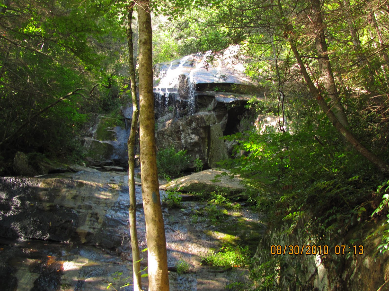
The hiking terrain was very versatile: under canopied tree cover; in the green tunnel; through pastures; through tall grass/weeds and over plank-covered marsh areas.  This made for an interesting hike.  There were numerous deer spotting along the way; however, the only other animals we saw today were cows.

The weather started off overcast which later became a light rain that cleared up and out popped the sun to turn the trail into a sauna.  So the weather went from great hiking weather to not so good hiking weather.

We started the hike at Virginia State Road 42 where there was a great parking spot for hikers.  As we start, we see the large sign that states that the next ten miles is private land and that we should have a written permit from the land owner.  At two miles in, we start the climb to the top of Big Walker Mountain a climb of about 700 ft over a mile. Not super hard, but hard enough.  We dropped off it into Crawfish Valley and right back up Cullion Mountain which was about a 700 ft climb too.  From there, it was a gradual descent to VA617 with a couple of 100 ft bumps.  Other than being hot and tired at the end of the day, we enjoyed the hike.

Another Green Tunnel


Tall grass, weeds and apple trees


Plank covered marshland

Date:  8/19/11
Trail Section:  VA615 Settlers Museum to VA617
Distance:  Approximately 4 miles

Today my cousin Tom and his friend Ted came up to hike with us for two days.  We knew that they would get in late in the morning so we planned a short, easy hike for the day.  It was a short, gentle hike through forest, old apple orchards, high grasses and blackberry patches.  As Ted told Ellen when we came in, "we sort of grazed our way from one point to the other".  It was a fun, easy hike.


I don't know who Tom is about to throw the apple at!


Ted supervising Tom and Richard on how to pick and eat blackberries


Date:  8/20/11
Trail Section:  Elk Garden to Grayson Highlands State Park’s Rhododendron Trail
Distance:  Approximately 8 miles

Early on we skipped this portion of the trail and saved it to hike for when Tom and Ted came.  This is one of the prettier parts of the AT in Virginia. It includes Mount Rogers (the highest peak in Virginia) and Grayson Highlands State Park.
The hike starts with a gradual 700 ft climb for the first four miles up to Mount Rogers Summit Trail and Thomas Knob Shelter.  On the way up we stop at Brier Ridge Saddle for lunch and have our first encounter with the feral ponies in the highlands.  At Thomas Knob Shelter we start meeting other hikers coming up from the state park.  Before the hike is over there will be hundreds of hikers.  One of these hikers mentioned the rocky climb from the park up to Thomas Knob Shelter.  She wasn’t lying, there were a lot of very large rocks.  This made the hiking, which should have been easy, very hard especially on knees and feet.

At and near Thomas Knob there were huge black flies.  As we walked in shaded areas near thick growth and at Thomas Knob Shelter, thousands of flies get airborn, fly all around us, but never land on us.  It was weird with that many flies and none landing on us.  We must have really smelled bad.

On the way down Tom and I climbed a rock formation for the view and got separated from Richard and Ted.  As we were trying to catch up with them, a hiker stopped us and asked where we were.  He had maps but was confused as to what direction was what.  After numerous times of telling him what was north and south on the AT, he kept trying to go south when he wanted to go north.  Even when one of his hiking partners tried to correct him he would not listen.  Tom and I tried to help him with his maps and decided that it was not detailed enough so I broke out my maps and tried to show him.  He still would not listen.  He knew he was lost when he asked for his location he just wasn’t going to accept that he was wrong.  I even tried to convince him to hike down to the state park offices.  He was not listening.  Tom and I finally left him and his hiking group, knowing that no matter what we said he would not listen.  I just hope someone in his group could convince him he was wrong, or take over leadership of the group.

The views, the large rock formations, climbing these formations, the alpine-like environment and even the tourists (especially the lost ones) all made this hike memorable.  However the thing that made it most memorable to me were the ponies and one pony in particular.  There were a lot of ponies on the trail so you expect them at any time.  One came out of the trees right up to me before I realized it.  I reached out and scratched its nose and walked on.  About 100 feet down the trail I stopped to look at a pony foal and I feel this nudge on my hand; it is the pony whose nose I had scratched.  It appears she wants my arm over her neck.  So, I place my arm over her neck and she stays there for several minutes just as happy as she can be.

This has been a hard, memorable day of hiking, and the prettiest hike this year.  I am glad that Tom and Ted were able to hike with us.  This is their last day of hiking with us this year.

One of the first feral ponies we see


Alpine environment


Huge rock outcrops with tourists


The pony who needed a neck hug


Sunday, August 21, 2011

Daily Diaries (8/17/11)

Date:  8/17/11
Trail Section:  VA615, Settlers Museum to USFS86
Distance:  4.75 miles

Today, to beat the closed road, Richard and I parked and walked in 4-¾ miles and then back out over the same portion of the trail.  We walked from Settlers Museum atop Glade Mtn. about 3-¾ miles with a 1400 foot climb and down to USFS86 approximately one mile with a descent of about 600 ft.  The Settlers Museum is an 1890’s Southwest Virginia village replica.


Me in Front of a Replica of an Old Schoolhouse at Settlers Museum

What nature offers us to see and how we feel while hiking the trail are the primary reasons for writing the blog, so that I can share it with people who are important to me.  Today it was not what I saw or how the hiking made me feel because they were both great; but the thing that has made the biggest impact on me thus far is who I met and the story he told me.

We were back at Settlers Museum after the hike and headed to the car when I met the gentleman and his wife painting a shelter with picnic tables under it.  When Richard walked up, the gentleman asked if we were vets.  When we said yes, he said I have a great war story to tell you.  Unfortunately I was so engrossed in his story(ies), I did not get his picture.

Below is an abridged version of his story that he told:

Forty-two years ago, a nine-year old girl from near Chattanooga wrote a get well card to an unknown wounded Marine who was on a hospital ship off the coast of Vietnam.

Resting aboard the USS Sanctuary and stitched up after being shot in the leg and filled with shrapnel, 19-year-old Marine Private First Class Richard Hamm received the card from the nine year-old, Cyndi Owen.  He replied to her card and wrote her back four or five times during the time he was aboard the Sanctuary.  After being told that from the Sanctuary he would be sent to Camp Lejune, he promised that he would visit her in Chattanooga.  Unfortunately he would be sent back to Vietnam for four more months.  During the process of going back to Vietnam he lost her name and address, thus all contact with the nine year-old back in the world was lost.  After being discharged from the Marine Corps, he returned to Smyth County where for the next four decades he has lived and worked.

Over forty years later the girl, using Facebook, discovered there were 54 Richard Hamms.  She contacted two of them; one of which was Private First Class Richard Hamm’s son.  Through her Facebook contact with Richard Hamm’s son, she and the elder Hamm reunited.  The date of the Facebook exchange was November 11, 2009, Veterans Day.

On January 9, 2010, Richard Hamm finally made the four decade-old promised visit to the nine-year old, who is now 54 years old.  Hamm turned 63 on Jan. 12 and said meeting his wartime pen pal “was the best birthday present I ever got.  She made me a birthday cake and gave me a couple of presents.”

Hamm stated “When we came back from Vietnam, we weren’t treated the best.  Something like this makes up for it.  It’s unbelievable.”

A complete write-up of his story can be found on the following website:

http://www.vawatchdog.org/10/nf10/nfjan10/nf012810-5.htm


What a Great Day For a Vet!

Wednesday, August 17, 2011

Daily Diaries (8/12/11 - 8/15/11)

Date:  8/12/11
Trail Section:  Dickey Gap to State Road 601 Crossing
Distance:  11.5 miles

This will be a day hike as will several of the next hikes. We drop Richard’s car off at SR 601 crossing, a very narrow rough gravel mountain road.  Ellen does not like ascending or descending on this road, too narrow. After a short drive on a winding mountain road, Ellen drops us off at Dickey Gap.

When we start the hike it is overcast and looks like it could start raining at any time. It soon clears up and the hiking weather is great. It is a good trail with a good grade. We start by climbing about 600 feet in 2-½ miles to high point trail; descend about 1400 feet in 4-½ miles to the South Fork of the Holston River; and finally an 800 foot climb for about 2-½ miles.

As I said earlier it was a good hike therefore not a lot of excitement. We saw deer, wild turkey, a snake, bear scat, great vistas and managed to pick a few blackberries along the way. We saw several deer, the turkey startled us, the snake acted as though it was invisible and the bear scat was fresh (that morning). We also stopped at Trimpi Shelter which was built in memory of a 18 year old boy in 1975; he died in 1969. I could not find out any more about the young man other than what was at the shelter.

Overall it was a good day for the hike.

Bet You Can't See Me


Quite a View


I Know That You Can't See Me


Richard Picking Some Blackberries


Date:  8/15/11
Trail Section:  USFS86 to VA601
Distance:  8.2 miles

We decide to hit the trail again after a two day lay off due to weather. Today is another uneventful day of great hiking with the exception of the following event. Richard parks his car at VA601; we then take my truck to USFS86. There is a small problem with getting to the trail on USFS86. An individual has posted the road as being a private road. It appears that when USFS86 was built in the 30’s the forest service failed to get the right of way for about 500 ft. of the road. This was never a problem until recently…the owners have declared it a private road.  Not knowing the history at the time and being the law abiding people that we are, Richard and I decide it is a USFS road and we are going to use it, which we did.  We found out the history when we stopped by Mt. Rogers Headquarters on the way back to the truck.  Knowing this, created some concerns especially with me.  It is my truck parked five miles up the road. We got it without any confrontations.


The weather today does not look that good.  It appears that it is going to rain at any moment for the entire hike.  The hike is a lot of up and downs with a slight downhill for the entire day.  It is very rocky the first four miles and pretty good trail the last four miles.  We even get back into a green tunnel on the last four miles.

At the midway point we stop for lunch at Partnership Shelter.  This shelter was built in 1998.  This is the first shelter that I have seen that has a warm water shower, definitely a plus for a through hiker.  In addition, no alcoholic beverages are allowed at the shelter.  The shelter is on the grounds of the Mt. Rogers National Recreational Area Headquarters, so everything around it is pretty much by the rules.

It didn’t rain on us but at times it was cool which was good.

Show Me The Trail


Shelter With Shower


Back Into The Green Tunnel

Friday, August 12, 2011

Daily Diaries (8/8/11 - 8/10/11)

Date:  8/8/11
Trail Section:  Elk Garden to Beartree Gap
Distance:  12 miles

After a year things are still the same with one major difference, there is now a 5th wheel trailer and Ellen is staying in it at what will probably be our base this year.  We start the day off in the same old early manner and the same old fog is still here.

Ellen drops us off at a place by the name of Elk Garden.  It got its name from a now extinct eastern elk that once roamed the area along with timber wolves and mountain lions.

We are ready...we think

From Elk Garden, we had a short climb 2-½ miles up White Top Mountain.  This is the second highest peak in Virginia; however, the trail did not go all the way to the top. It was so foggy that we couldn’t tell where we were.  Due to the fog, we nearly missed the only wildlife for the day when I startled a young deer.  Richard missed it due to the fog.


Just a little fog near the top of White Top Mountain

There was a cow standing guard on the trail.  The fog was the same when we got to Buzzard Rock.  From there, with a short break for lunch at Summit Cut, we hiked on to Lost Mountain shelter, where we took a long and needed break.


Without the password, you can't use the trail

While at Lost Mountain shelter there were awesome breezes and thunder rumbling in the distance.  At this point we were eight miles into a planned 12 mile day.  Two miles further down the trail we have our first encounter with the Virginia Creeper trail.  It’s a trail that follows an old narrow gauge railroad.  At this point the AT follows the Va. Creeper trail for about ½ mile.  We are heading for Beartree Gap where we plan to spend the night.

Old rail beds make great trails

With less than ¼ mile from Beartree Gap, we encounter a torrential downpour.  We were able to get our pack covers on but not our rain jackets.  We got soaked to the bone.  We also found out that our boots were waterproof…they held every drop that ran down into them.  The area is flooded so the thought of putting up a tent in the rain promised everything would get wet including our sleeping bags.

We proceeded to look for shelter.  We hiked out to a highway and began walking.  After a short distance we spied a turn off for Beartree recreation area.  Surely there would be a covered picnic area where we could hide out until the storm blew over.  When we got to the entrance of the park (½ mile up the road), the park manager informed us that there were no shelters.

Soaking wet, lightning all around and beginning to get cold, we decided it was time to bail and get Ellen to come pick us up.  We were promptly informed there was no cell service, however the manager did have a phone for us to use.  Fortunately, even though it was a strange number Ellen answered the phone.  She said that it would probably take her two hours to get to us.  The manager let us stay in the rear of the entrance building until Ellen got there; he even gave us towels to use.  He and Ellen were our heroes.  Sorry there are no pictures of the two wet hikers.  We were too cold and too wet.  Our only goal was to get warm and dry.  After a long wait and a long ride back to the trailer, the hot shower was great.  However, I did not get warm until after I was in my dry, real bed for awhile.

Side note: On the way down Buzzard Rock towards Lost Mountain Shelter, we encounter three people, two ladies and a gentleman (late 70s early 80s).  They were counting rattlesnake root plants.  To quote one of the women, “not the crawly kind, the kind that grows in the ground.”  The variety here is getting rare and only grows in two places in the Appalachians.  When I ask what the plant is used for, one of the ladies responded “we don’t know; it is just getting rare.”  Below is a picture of the plant.


Date:  8/10/11
Trail Section:  Beartree Gap Trail to Damascus, VA
Distance:  11.7 miles

Even though the mileage indicates we walked 11.7 miles, that represents only the actual Appalachian Trail portion of it.  Ellen dropped us off at the entrance to the Beartree recreation area which is approximately ½ mile from the trail; and we had a ½ mile walk to where we thought there were tables to have lunch.  A great day for hiking.

The hike today starts out with an up and down climb of about 300 ft over 2-½ miles, nice grade and good trail.  From there we drop 1100 ft over the next 3-½ miles; a lot of down hill, left the feet a little sore.  From there a 600 ft climb to Iron Mountain trail over 2-½ miles with a sharp drop off into Damascus.  The hike was a great hike with the downhills leaving the legs and feet sore.  Trail for the most part was nice; only a few rocky areas.

For reading purposes this was a boring day with the exception of getting into Damascus with less than a ¼ mile to the car another downpour occurred.  However this time we were within 50 feet of an old empty gas station with shelter so we waited out the rain under the shelter.  I did (at Richard’s urging) call Ellen and request her to come pick us up and take us to the car so that we would not get wet, her edited response was only once this trip will I do that.

Some of the things we saw on the hike today were:

Scaly Rock

Trail Pet

Scene of a Rock Slide

Tuesday, September 7, 2010

Daily Diaries (9/5/10 - 9/6/10)

Date:  9/5/10
Trail Section:  Tenn 91 - Wilbur Dam Rd.
Distance:  16.1 miles

Today will be one of the longest, if not the longest, hikes we have had since we started at Springer Mtn. in Georgia.  Weather is perfect.  At the start, it is in the high 40s to low 50s, and a breeze is blowing just about all day.  With these temperatures, it is feeling more and more like fall.  We start with a decent climb the first two miles.  It is relatively level for the next six, then a long downhill until Wilbur Dam Rd.

No critter sightings today but there are a lot of trees.  Of interest today: we passed a monument to Nick (Uncle Nick) Grindstaff.  Nick had traveled west in the early 1880s to win his fortune but was robbed.  He returned to Iron Mountain where he lived as a hermit until he died 40 years later.  His memorial is a plaque placed on the chimney.  It was placed there in 1925, two years after his death.

Also on this hike, we had Watauga Lake in view for a lot of the time.  When TVA built the lake they displaced about 700 people.  With all the dams they built in the south, TVA displaced nearly 75,000 people.

In summary, even though the hike was a long hike it was an interesting one.


Nick Grindstaff memorial


Watauga Lake


Date:  9/6/10
Trail Section:  Low Gap (Shady Valley) - Damascus, VA
Distance:  15 miles

Today is the last day for this year’s Appalachian Trail hike.  It will be a fairly level hike for ten miles, then a slow descent into Damascus.  Should be an easy hike.  Weather is perfect for hiking again today.  We have been blessed with good weather for most of the last 200 miles.

With the knowledge that this will be the last hike on the AT this year and the anticipation of a juicy hamburger in Damascus make this day feel like the longest day we have hiked.  It wasn’t; we did it in 6.5 hours which includes stops for breaks.

We passed a shelter today (McQueens Knob Shelter) which was built in 1934; it looks it.  Near the shelter on McQueens Knob, there were concrete bases for towers that were constructed in 1932.  There was no indication as to what the towers were for.  However, being engineers, we made the assumption that they were for a radio repeater.

In addition, we crossed into another state (Virginia), three down eleven to go.  And at the end of today’s hike we only have 1,715.6 miles left to hike on the AT to complete it.

The hamburger was delicious (sorry no picture of the burger).  Now the wait until Ellen and Margie arrive.  Until then, it is laundry, cleaning up the hiking gear and several good naps.

Thank you all for your comments, I enjoyed them.


McQueens Knob Shelter


Richard


Jerry

Saturday, September 4, 2010

Daily Diaries (9/1/10 - 9/3/10)

Date:  9/1/10
Trail Section:  Walnut Mtn. Rd. - Dennis Cove
Distance:  14.0 miles

The day starts out cool, it is feeling a lot like fall.  Even some of the leaves are calling it fall and changing colors, then falling.  This was a good day for a hike.  It was a long hike with the only drawback being the long descent from the top.  This was hard on the feet and legs.

There were few good views however, as most of the walk was tree covered.  We did have a critter encounter today.  The critter was a little brown snake.  It thought its camouflage was good enough that it could not be seen.  It just lay in the trail very still, and did not move while we were there.

In addition, the cold soda that we got at end of the day from a gas station was pretty fantastic.


Fall leaves


Small snake (he thinks we don't see it!)


Date:  9/2/10
Trail Section:  Dennis Cove - Wilbur Dam Rd.
Distance:  13.1 miles
 
The drive out to where we park the return vehicle at Watauga Lake was beautiful.  Lots of red barns, cows, pasture land and the river.  The trail on the other hand offered some wicked climbing into the river’s gorge, followed with an 1800 foot climb out, followed by another long descent.


The critter encounter today was a large spider that decided it did not want its picture taken so it hid in a hole before I could get the camera out.


We had snacks by a pretty Watauga Lake.  We then crossed our second dam on the AT.  The downside to being near the lake was that there was no breeze.  This coupled with reflections off the lake made it warm.


All in all it was another great day of hiking.


Rural scene


Camera-shy spider's web


Watauga Lake

 
Date:  9/3/10
Trail Section:  Low Gap (Shady Valley) - Tenn. 91
Distance:  6.5 miles

Today we opted for a short day and easy day.  The critter encounter today was a fast-moving tortoise on its through-hike from Low Gap to Tenn. 91; hopes to make it before the first snow (all 6.5 miles).  Near the end of this hike we came across a section of the trail that has been set up to accept wheelchairs so that everyone can enjoy the AT.


Along the way we met another hiker who informed us of an ice chest left by trail angels that had soda and candy in it.  The ice chest was just out of view from the public on the trail just beyond where we parked.  We did not partake because we had our own; but it still makes me feel good knowing that these people (Trail Angels) are still out there. A great way to end the day.


View at the start of today's hike


Tortoise


Wheelchair accessible portion of the trail

Tuesday, August 31, 2010

Daily Diaries (8/29/10 - 8/30/10)

Date:  8/29/10
Trail Section:  Carvers Gap - US 19E
Distance:  14.4 miles

With Roan Mtn. at our back, we begin today with a climb to the top of Round Bald.  This is the first of a series of balds that we will climb today.  FYI, balds are areas on mountain tops where there are no trees. While none of the southern portion of the Appalachian Trail rises above the tree line, scientists are mystified as to why there are no trees.

On Round Bald the USFS is conducting an experiment to remove non-native plants on balds.  There is a herd of Angora goats that love these plants, especially Canadian blackberry which is taking over the balds.  Guarding these goats is a pair of Great Pyrenees dogs.  When I got near the fence these two dogs let me know, in no uncertain terms, I should leave.  The fence is an electric fence that is solar powered, and there are warnings to the curious hiker to keep off it.

About five miles into the hike we reach Overmountain Shelter.  The shelter is an old red barn that has been renovated into a shelter for hikers and served as a back drop in the movie “Winter People”.

With movies on my mind I could not help but think of Julie Andrews and the “The Hills Are Alive With The Sound Of Music” as we were on top of both Little Hump Mountain Bald and Hump Mountain Bald.  They reminded me of the scene where she was running across the top of the mountain and singing.  It was very pretty there.

Seasonally, on the top of Hump Mountain, there is a herd of longhorn cows.  We just missed the season and therefore, the cows.  It looked as if they had been moved within the last week.

After the vigorous climbs to the tops of all the balds, the five mile descent was not going to be outdone in how hard it was.  At times the descents were very steep and over large, loose rocks.  This was very hard on the feet and the legs.

Today’s hike was a beautiful hike that I would recommend to anyone fit enough for it.  If I have the opportunity to do it again, it will be a two to three day hike so that I can enjoy all the beauty there is at different times of the day.


Roan Mountain as seen from Round Bald


Great Pyrenees guard dog telling me to move on!


Angora goat telling me not to listen to dog


Overmountain Shelter


Hump Mountain Bald


Trail descending off Hump Mountain


Date:  8/30/10
Trail Section:  US 19E - Walnut Mtn. Rd
Distance: 10.4 miles

When we started this morning, the weather was cool and clear; however the vegetation was saturated with dew, thus we got very wet.  In addition to getting wet, this section of the trail was one of the most poorly marked sections that we have been on.  When we came to intersections with other trails we had to search for the right trail.  At times we had to go up the trails as much as 200 ft before we found a blaze letting us know we were on the right trail.

Other than these minor problems this was a pretty hike that was up and down.  It provided us with a couple of waterfalls, about a mile of hiking along a creek, and plenty of climbing.

This hike drove home the point to me the need for drinking, eating and resting periodically.  Due to the nature of the trail (not that strenuous or that hot), I nearly went too far without doing this.


Jones Falls


A creek we followed for about a mile